Projects
First Semester. Municipal Information System
The Geographic Information System for municipal management is conceived as an integrated system for the alphanumeric and spatial information generated and used by the municipality. The GIS makes it possible to capture, store, analyse and visualise geospatial data linked to geographical locations within the municipality and its territorial context. It is conceived as a tool to improve municipal management and decision-making.
The implementation of a corporate GIS offers numerous benefits that justify the effort involved in developing the project and changing working methodologies. It enables the municipality to have and work with a single, up-to-date municipal cartographic database. In addition, the use of GIS tools for geoprocessing and network analysis facilitates a more comprehensive understanding of territorial dynamics.
The main objective of the project is to create, implement and use a corporate GIS for the municipal management of Matadepera Town Council. The system should make it possible to:
- store data,
- visualise and query information,
- analyse and model processes,
- share and publish results,
- and support decision-making.
The project integrates knowledge from the courses on geospatial data, databases, navigation and Earth observation, Geographic Information Systems, geoprocessing and geoservices.
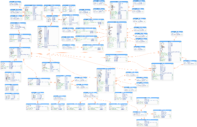
The first step in developing the Municipal GIS is to define and implement a corporate geodatabase for the storage, maintenance and management of municipal information. At this stage of the project, students apply the knowledge acquired in the courses on databases, geospatial data and Geographic Information Systems.
Working with real data and municipalities promotes meaningful, practical and competency-based learning, providing students with a learning experience that closely reflects professional practice.
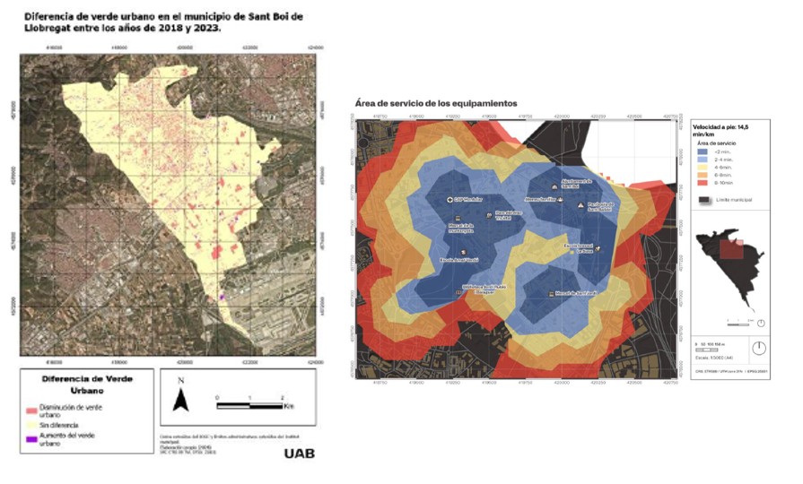
Based on the knowledge acquired in the Geographic Information Systems course, students develop a data analysis workflow that enables them to address problems and practical cases in different areas of municipal management. By applying the course content—including cartographic analysis, map algebra, network analysis operations and terrain analysis—students are able to exploit and enrich the information system and obtain results that can be applied to municipal management.
One example of this application is the calculation of service areas for municipal facilities using network analysis, which makes it possible to identify coverage areas and detect potential gaps or overlaps in service provision.
Another example is the analysis of changes in urban green space between two years. This analysis makes it possible to study the evolution of green spaces within the municipality and assess their spatial distribution. Using map algebra techniques and land-cover comparison, students identify areas that have gained or lost green space over the period analysed.
This exercise highlights the value of GIS as a tool for monitoring urban change and supporting decision-making in environmental planning and management.
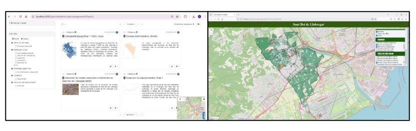
The project includes the creation of a metadata catalogue and a web viewer for municipal information, applying the knowledge acquired in the Geoservices course. The catalogue enables geospatial data to be documented and organised in a structured way, making it easier to search for and understand. The web viewer, in turn, provides an accessible platform for consulting the available information and interactively visualising and exploring geographic data. This contributes to the municipality's objectives of transparency and access to information.
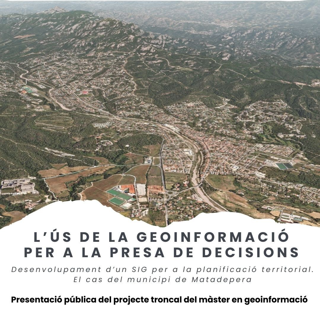
Projects developed by Master's Degree students during the 2025–2026 academic year:
- The Integrative Role of GIS in Territorial Management. Case Study: Matadepera (Grabiel Aldana, Enzo Bresola, Leidy Correa, Manel Escudero, Fatima Hamza) Watch the video
- Integrated Environmental and Territorial Assessment for the Planning of Matadepera (Andy Cabal, Youness Mouden, Manuela Arias, Marta Roca, Guillem Salvador) Watch the video
- Using Municipal GIS to Understand, Manage and Plan Sustainable Tourism in Matadepera (Jordi Sanmartí, Andrei L. Turlea, Rut E. Bonhora, Miquel Ferrer, Iván Campos) Watch the video
- Using a GIS Viewer to Improve Public Policies Applied to Transport: A Case Study of Matadepera (Ángel J. Calvijo, Júlia Ferrer, Ameneh Alcalá, José M. Gallardo) Watch the video
- People of the Present. Demography and Urban Context (Ignasi Fuente, Pi Marín, Montse Oviedo, Iván Aragón, Pere Llorens) Watch the video
Second Semester. Specialisation Project
Cities are constantly growing. By 2050, almost 70% of the world's population is expected to live in urban areas. This projection contrasts with climate scenarios involving both an increase in the intensity and frequency of rainfall and rising temperatures. Phenomena such as the urban heat island effect are among the main causes of mortality in the developed world.
Understanding the morphology of cities, their green spaces, prevailing wind patterns, mobility patterns, traffic and air pollution has become essential geoinformation in both present and future scenarios, enabling the analysis, design and implementation of mitigation and adaptation measures.
The Specialisation Project in Geoinformation Management and Smart Cities will begin with the implementation in the classroom of new methodologies aimed at fostering and promoting creativity, innovation and idea generation, known as Design Thinking, applied to the field of geoinformation. Through research, challenge identification, prototyping and the design of a product and service proposal, all stages involved in generating added value from geoinformation will be analysed.
The focus of the project will be on finding ideas and solutions to the sustainability and resilience challenges posed to urban ecosystems by the impacts of climate change and urban growth. The aim will therefore be to develop an idea through to the product or service architecture stage, viewing the smart city as one that responds sustainably and/or resiliently to the challenge of improving its citizens' quality of life. To this end, the proposal will be developed in the context of a real European Horizon 2020 (H2020) opportunity call, specifically the Call Visionary and Integrated Solutions to Improve Well-being and Health in Cities – Topic description SC5-14-2019.
The project consists of developing a GeoApp that allows users to consult a municipality’s cadastral and service data, as well as report incidents in public spaces. The project will be developed as closely as possible to a real-world case. Data from the Geospatial Systems project will be used.
Given the nature of the project, it will primarily put into practice the knowledge acquired across all the subjects in the specialisation. It will also draw on content introduced in other subjects within the Programming Techniques and Geoinformation Resources specialisation, as well as in the common component of the programme.
This is a project that brings together everything learned throughout the Master's Degree: PhoneGap as the development platform for the GeoApp, JavaScript as the client-side programming language, and PHP as the server-side language, with a connection to a MySQL database. In addition, students will be able to choose the mapping library: Leaflet or OpenLayers.