Equipments
The Department of Geography has the necessary facilities and equipment to carry out its research and teaching tasks. It has the Physical Geography Laboratory, the Postgraduate Room, hardware to offer hosting services on its own server, reproduction and scanning to members of the Department. He is also in charge of the academic coordination of the UAB Map Library.

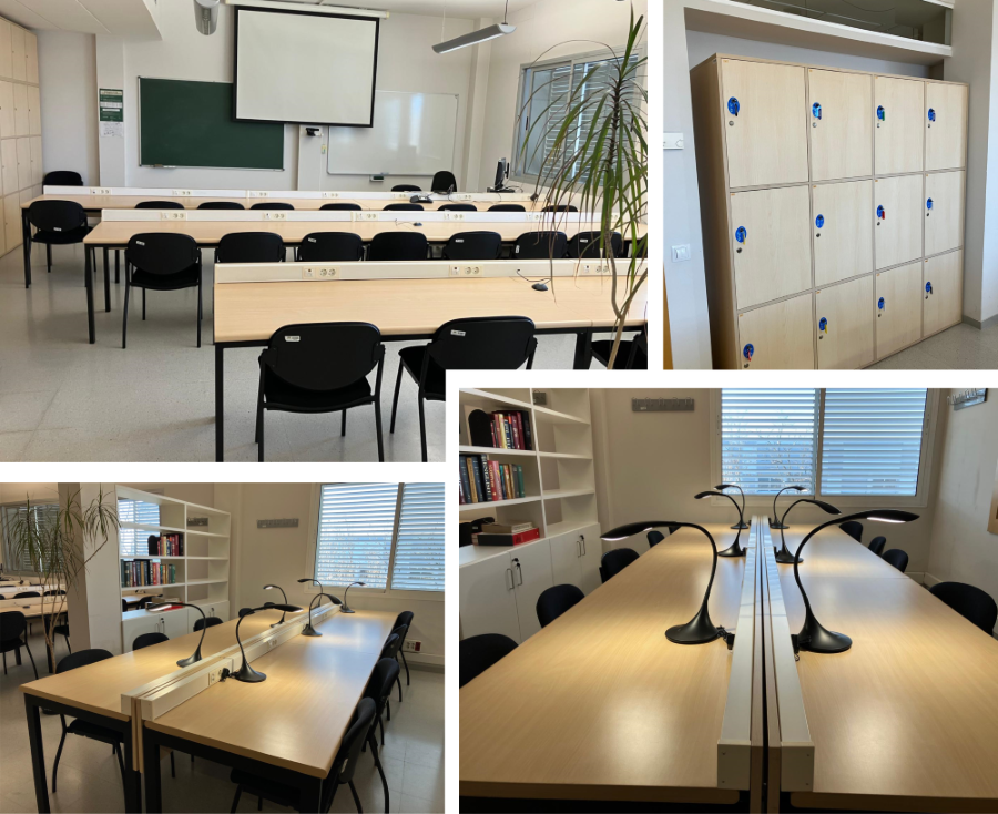
The Enric Lluch Room is a renovated space within the Department of Geography, designed to provide a comfortable and functional environment for academic work and research.
The space has been reorganized to incorporate elements that address the needs of study and collaboration, including:
- New furniture, prioritizing ergonomics and comfort.
- Lockers with a coin-operated locking system, allowing for secure storage of personal belongings.
- Access through a numeric code, facilitating and ensuring access for postgraduate and doctoral students of the Department.
The room is divided into two distinct areas:
- An area designated for individual work, equipped with spacious desks, power outlets, and lamps for each workstation, creating a suitable environment for focus and productivity.
- A space designed for meetings and group activities, featuring a whiteboard, projector, and computer to facilitate more collaborative sessions.
These improvements make the Enric Lluch Postgraduate Room a space designed for research and academic work, fostering a stimulating environment tailored to current needs.

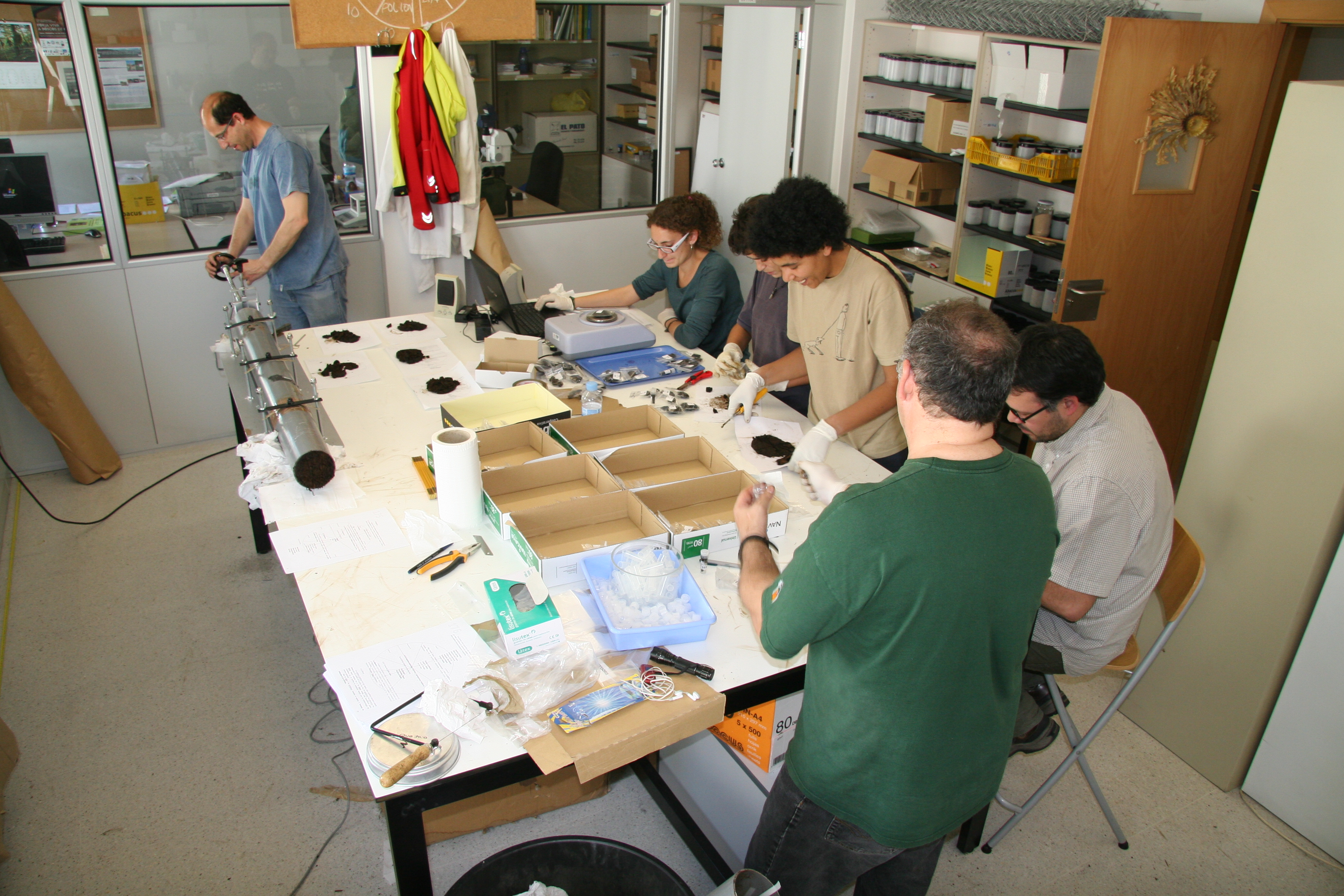
The Physical Geography laboratory is equipped with the necessary instruments to carry out different tasks related to the study of the natural environment.
It has the necessary equipment for the preparation of sedimentary coal samples, plant macro-residues and soil analysis: water point, sieves and extractor hood. As well as the equipment needed to open, treat and store sedimentary evidence: sedimentary extractor and refrigerators. It has optical microscopy equipment, magnifying glasses. Oven and muffle for drying samples and calcining organic matter and precision scales.
The Department has its own equipment to carry out its research tasks:
- Servers with processing capacity:
We have wide processing capacity with various computers for massive parallel calculations with MiraMon and other specialized programs, as well as for experimentation and applications in geoservices. Specifically, we have 31 servers with 63 processors and 302 cores, with a total of 664 GB of RAM.
- Meteosat Second Generation Antenna (MSG):
Due to major improvements in the Meteosat Second Generation(MSG), operating since 2004 and with a minimum continuity until 2015, from CREAF we believed that the current MSG resolutions could help in various fields of interest including radiometric correction of other sensors, Vegetation index calculations, active fires, aerosols studies and climate change, among others. So, with a low budget was installed and launched, in 2007, a receiving station, taking advantage of the free data for research groups. Every 15 minutes we receive the MSG images that are imported into MiraMon software format, for a further internal CREAF-UAB staff use. Besides MSG images, we can also receive images from other meteorological satellites (Metop, GOES, etc.) Processed products as well.
- Field Radiometers:
It has been acquired recently, by the Department of Geography at the UAB, two field radiometers with detectors in the range of visible, near infrared and shortwave infrared, divided into ranges (200-1100 nm) and (900 -2500 nm).
It is an USB2000+ spectrometer and a near infrared spectrometer NIRQuest256-2.5, both from Ocean Optics. These are the main features:
USB2000+ Miniature Fiber Optic Spectrometer: consists of an analog to digital converter of 2MHz, programmable electronics, a 2048 CCD detector elements, and a USB 2.0 Hi-Speed¿¿. Provides a resolution of 0.35 nm (FWHM).
NIRQuest256-2.5 Near-Infrared Spectrometer: comprises a linear-type detector 256 pixels and an optical resolution of 9.5 nm (FWHM).
- Meterological stations:
We have a meteorological station in Vallcebre, in a meadow area, equipped with the following instrumentation:
-Air temperature sensor.
-Relative humidity.
-Two ST sensors.
-Incident and reflected solar radiation (albedo can be calculated).
-Skye Sensor R + G+ B + Irp configuration similar to Landsat-5-7-LDCM and some bands of MODIS.
-Soil Moisture (sensor belonging to IDAEA).
-Flow soil heat sensors (sensors belonging to IDAEA).
-Wind speed and direction.
-Net radiation.
-Precipitation.
These stations provide a validation area for radiometric correction and satellite images, and in the same time, allow the development of moisture indices joining solar and thermal bands.
- Drone + sensor:
We have recently acquired a DJI Matrice M210 RTK v2, a quadcopter with 38 minutes of autonomy and a payload capacity of up to approximately 2Kg. This platform, together with the D-RTK 2 mobile station (compatible with the most important satellite navigation systems) that we also have, allows us to obtain centimeter-accurate positioning. The drone has several security systems such as a sensor for the detection of obstacles or transmission systems of switchable frequency in real time that avoid possible interference.
On the other hand, the MAYA-S2 multisprectral sensor has been acquired, which has 9 bands with a configuration practically identical to those of the Sentinel-2 satellites. An ILS sensor (Incident Light Sensor) has also been acquired to correct the possible effects of changes in the images captured in the same flight.
Per altra banda, s'ha adquirit el sensor multiesprectral MAIA-S2 que disposa de 9 bandes amb una configuració pràcticament idèntica a les dels satèl·lits Sentinel-2. També s'ha adquirit un sensor ILS (Incident Light Sensor) per corregir els possibles efectes dels canvis en les imatges captades en un mateix vol.
- Devices:
PLOTTER: HP DESIGNJET 1055CM (maximum print size A0, four inks, can print at 600dpi and 1200dpi in gray color with a minimum thickness of 0.02mm line).
LARGE FORMAT SCANNER: Colortrac Smart LF 4080e (A0 format, 400 dpi, 24-bit color depth).
A3 SCANNER: EPSON EXPRESSION 1640XL (A3, 1600dpi, 42-bit color depth).
SCANNER SLIDE / NEGATIVES: Nikon SuperCoolScan 4000 ED (4000dpi optical resolution, 16-bit color depth).

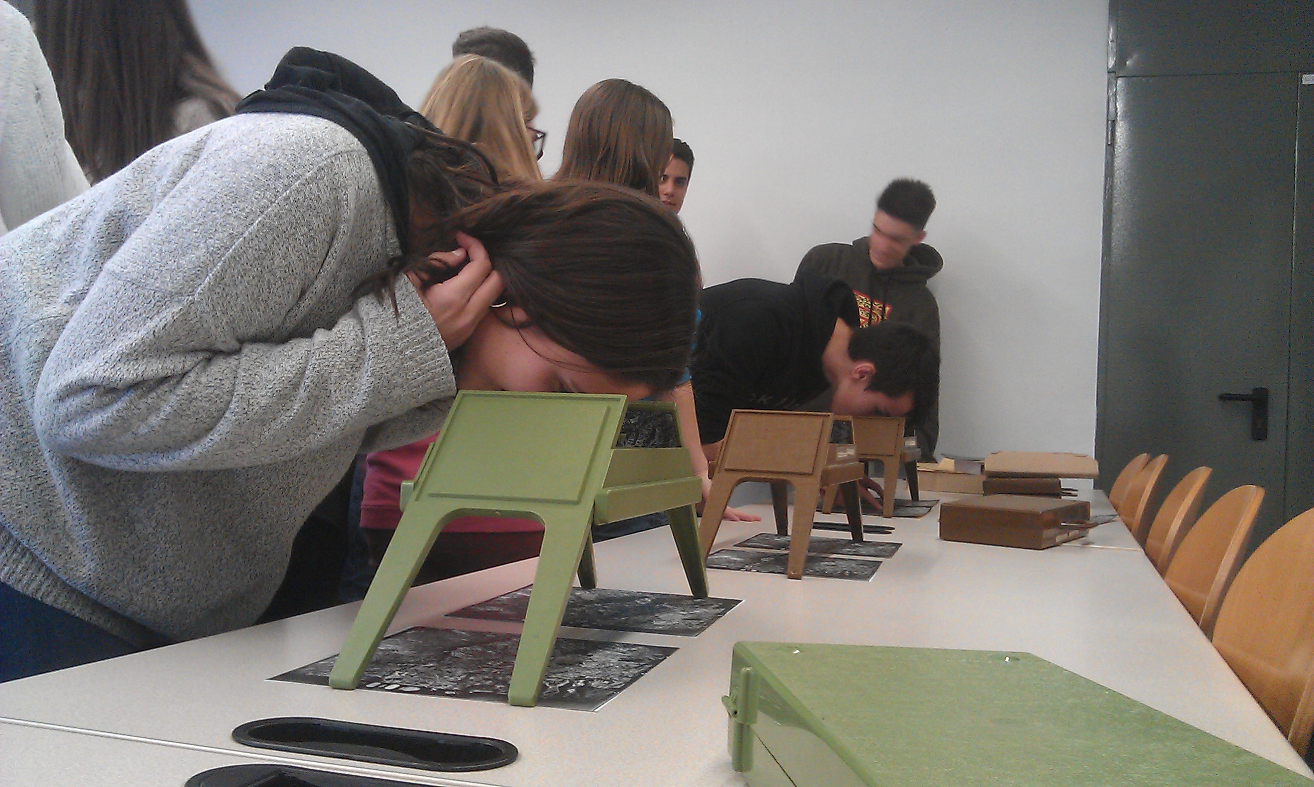
The Department of Geography is in charge of the academic coordination of the UAB Map Library.
The Map Library is located inside the Humanities Library building. For document reproduction, you can use the self-service photocopiers and the Library's photocopy service.