First results of the European PEGASO project
31/10/2012
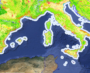
The ten pilot regions of the European PEGASO project are advancing swiftly on the generation of essential data at different geographic levels and in the creation of a new regional scenario in which to apply the new ICZM in the Mediterranean. With new data available, experts in research, government officials and university representatives of all the Mediterranean and Black Sea regions met in Ostende, Belgium, from 22 to 25 October to obtain their "licence" to be used on the most powerful highway of the Mediterranean in the management of coastal regions: the PEGASO SDI.
The PEGASO SDI: a highway towards a better management of the coasts of the Mediterranean and the Black Sea
A Spatial Data Infrastructure or SDI is a group of technologies, policies, standards, services and human resources that ? taken together ? allow for the compilation, manipulation, access, distribution and use of geographical data. One could say that an SDI is an instrument for the distribution and sharing of spatial data, by different kinds of users (public and private sector, academic, governmental or citizens organisations). Conceptually, we can compare what an SDI does for the distribution and sharing of data, with the function that the roads and highways fulfil for our transport purposes.
The PEGASO SDI is designed to support the PEGASO shared Governance Platform for the delivery of integrated Coastal Zone Management. The construction of the SDI involves a collaborative process, to define common objectives, targets and actions. It is therefore crucial to achieve a common understanding and common view on how the PEGASO SDI can deliver the objectives to all other partner institutions.
This capacity building within PEGASO SDI consists of an e-learning platform; a 'hands-on' training session organised by the Flanders Marine Institute (VLIZ, Marine and Coastal Research and Management, Flanders), the University Pablo de Olavide (UPO) and the Universitat Autònoma de Barcelona; and a guideline on how to harmonise and share spatial data. Other joint workshops will be held to discuss the tools and scenarios existing in pilot projects in November in France, organised by the Tour du Valat, and in Istanbul in December.
"We consider the PEGASO Platform to be the main reference point in the future for coastal management initiatives", comments Françoise Breton, coordinator of the PEGASO project at Universitat Autònoma de Barcelona. "We are already establishing links with other developing platforms such as the Mediterranean Action Plan (MAP) and the United Nations Environment Programme (UNEP). We would also like to invite all those projects and initiatives to contribute to the platform and provide examples of coastal management in accordance with the principles of ICZM. "