3D Surveying Practice with LiDAR Technology in the Master’s Degree in Geoinformation
Students from the Master’s Degree in Geoinformation at the Universitat Autònoma de Barcelona, in collaboration with the Institut Cartogràfic i Geològic de Catalunya, carried out a hands-on session using a terrestrial LiDAR sensor and SLAM technology to gain first-hand experience of the full workflow for 3D data capture and model generation. The training session was conducted with the participation of GeoLímits.
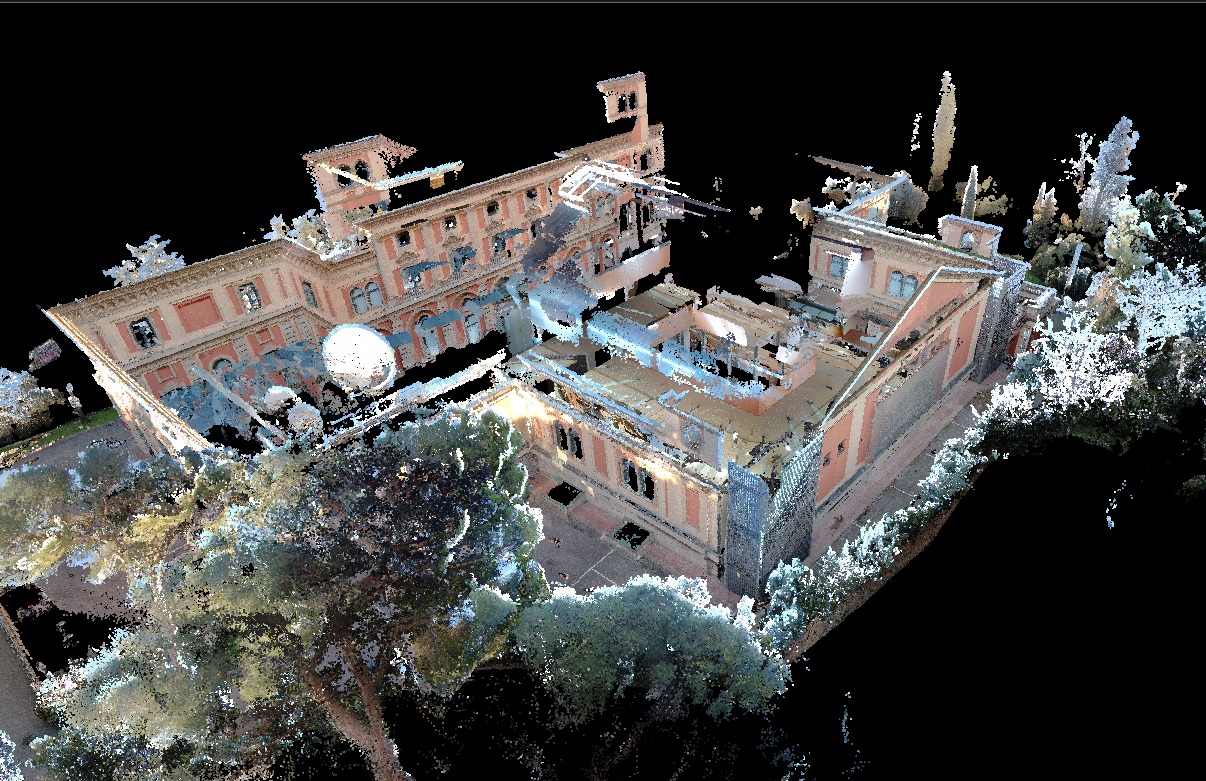
On Wednesday, February 18, students enrolled in the course 3D Projects and Business Strategies in Geoinformation, part of the Geoinformation Management specialization of the Master’s Degree in Geoinformation at the Department of Geography of the Universitat Autònoma de Barcelona and the Institut Cartogràfic i Geològic de Catalunya, carried out a 3D surveying practice using a terrestrial LiDAR sensor (TLS) and a SLAM (Simultaneous Localization and Mapping) system.
The activity was designed as a hands-on session focused on the real-world application of large-scale 3D spatial data capture technologies. The aim was for students to gain first-hand experience of how laser scanners operate and to understand the different stages of the workflow: survey planning, fieldwork, point cloud processing, and the generation of the resulting 3D models.
This experience enabled students to deepen their understanding of both the technical aspects of 3D surveying and its strategic and professional dimensions, exploring potential fields of application in geoinformation projects and in the development of sector-related services. The session was coordinated by Ariadna Just, lecturer of the Geoinformation 3D course, and delivered by Oriol Boixareu from the company GeoLímits, to whom we would like to express our special thanks for his participation and contribution to enhancing the students’ practical training.
The photographs from the session show both behind-the-scenes moments of the fieldwork and some of the results obtained, highlighting the potential of this technology for generating high-precision 3D models.