Network of paths on the Bellaterra campus
Routes and paths to explore the campus from end to end
The network of paths consists of six routes that cross the three small valleys formed by the streams of Can Miró, Can Magrans and Can Domènec, which comprise a large part of our campus. Each of the proposed routes can be walked in 25-40 minutes at a good rhythm.
The routes cross each other directly or by connecting paths, so that everyone can design the itinerary according to their own convenience or can make a proposed itinerary.
You can download a map with distances or take a virtual.tour of the path network (documents from 2011, when the path network was extended).
Sky blue route - between forest and crops
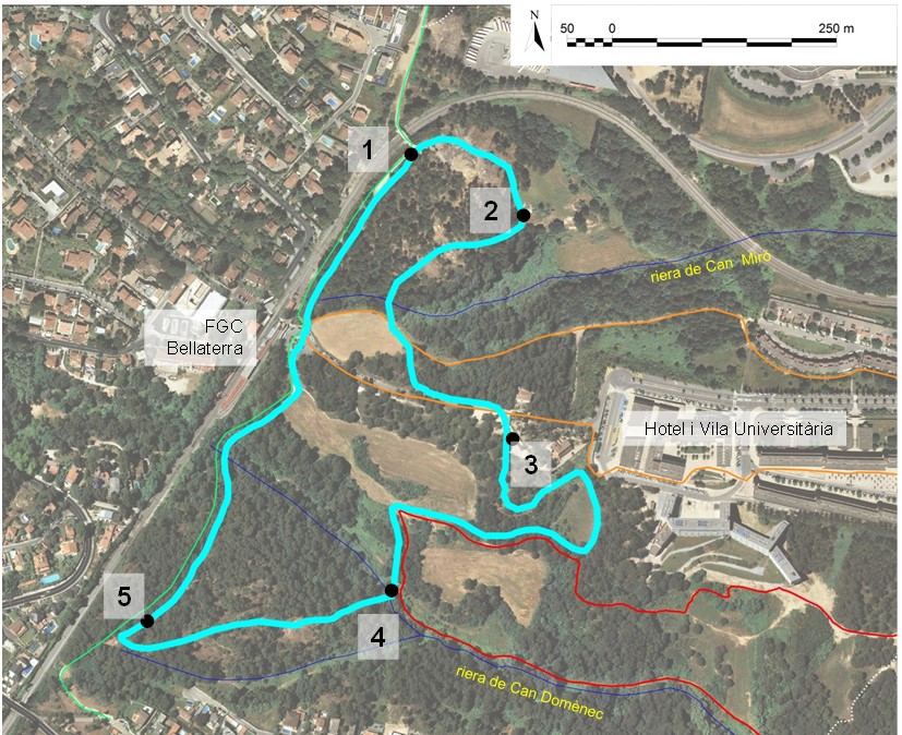
Sky blue route leaflet (document in Catalan)
Route on the wikiloc website
Orange route -the old Can Miró path, Ho Chi Minh and other stories
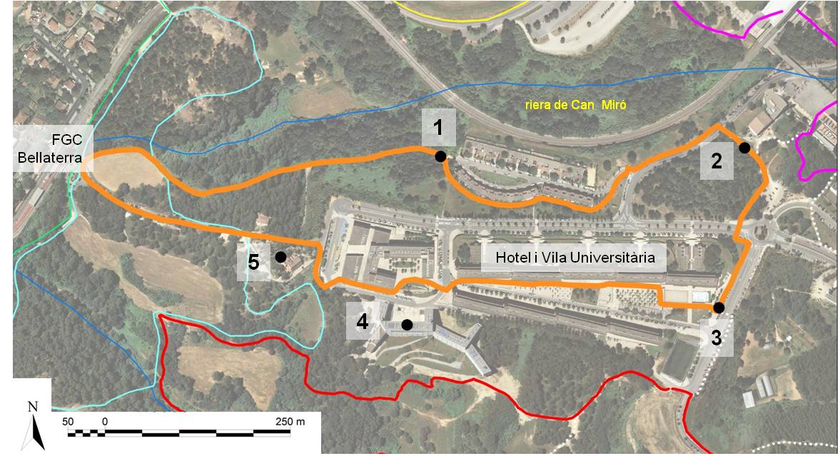
Orange route leaflet (in Catalan)
Route on the wiikiloc website
Yellow route - a very illustrated GR trail
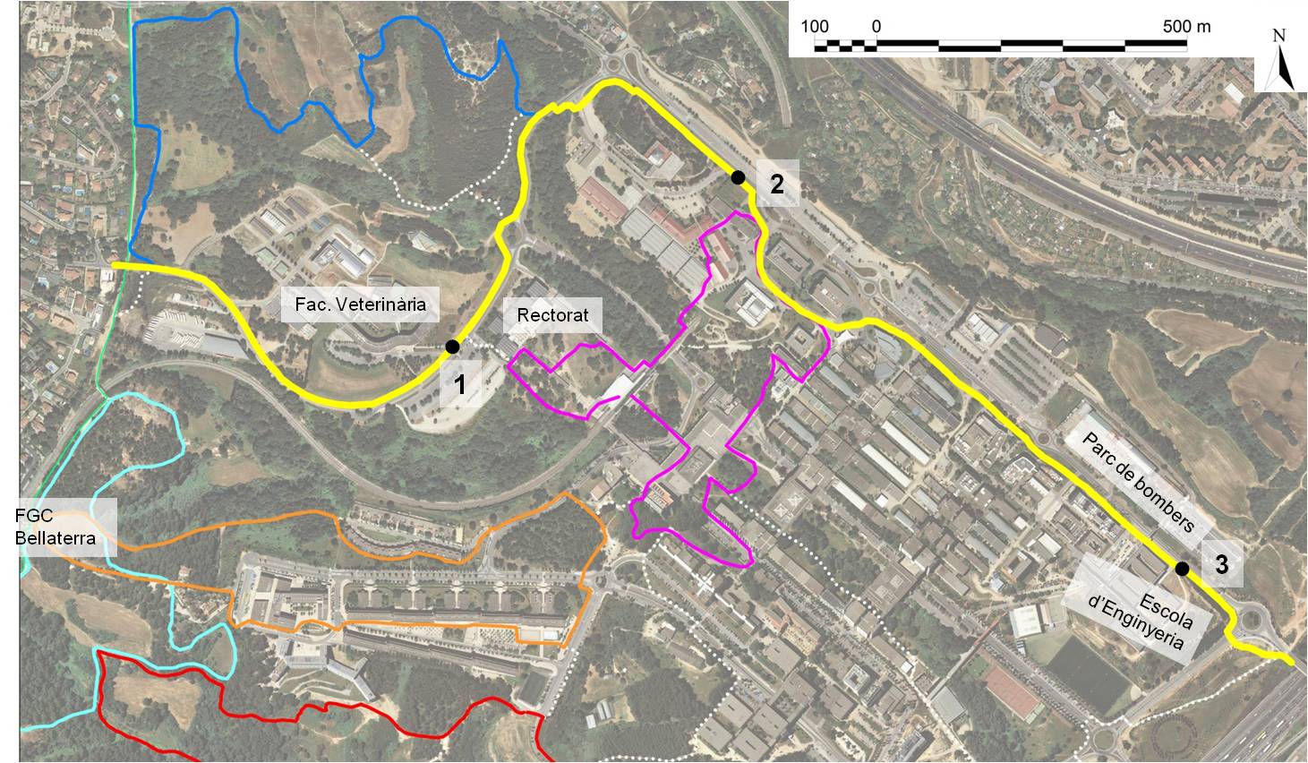
Yellow route leaflet (documento in Catalan)
Route on the wikiloc website
Magenta route - corners between the academy
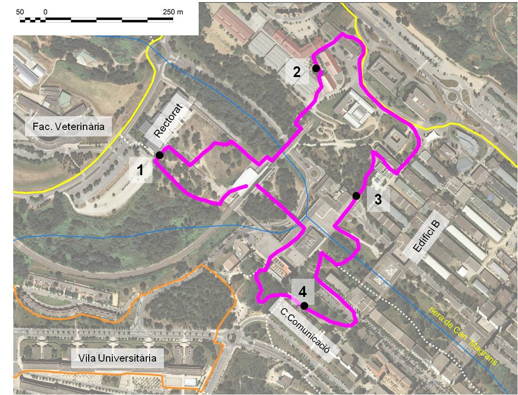
Magenta route leaflet (in Catalan)
Route on the wikiloc website
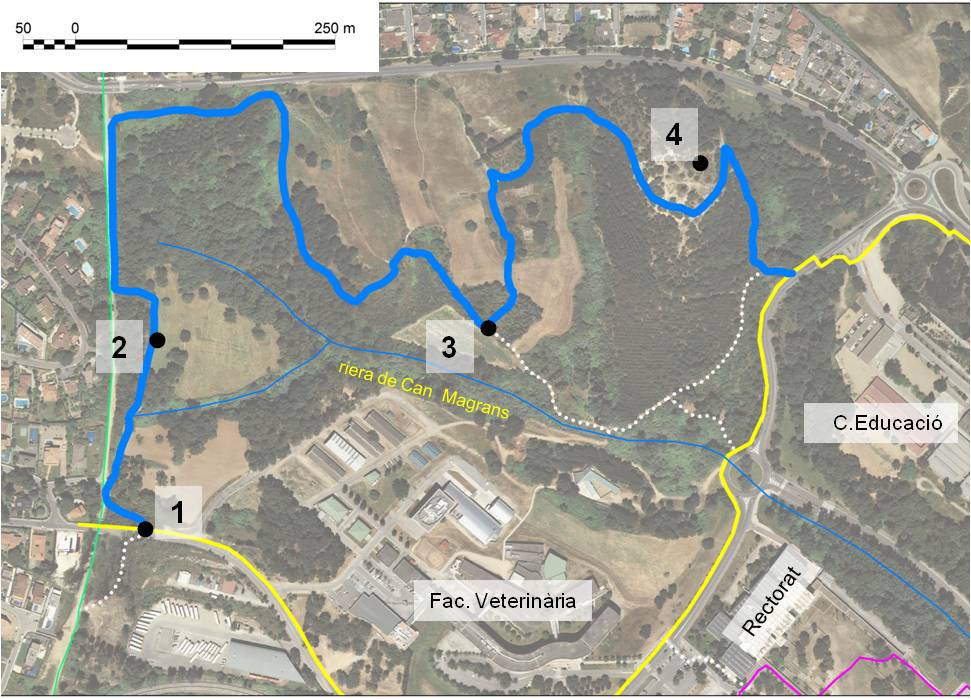
Blue route - Can Magrans nature trail
Blue route leaflet (document in Catalan)
Route on the wikiloc website
Campus Nature Trails Notebok (document in Catalan)
Blue nature trail -Can Magrans
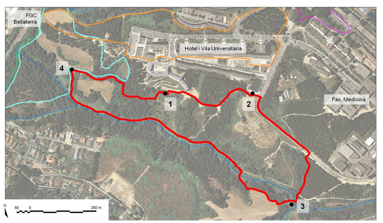
Red route - Can Domènec nature trail
Red route leaflet (document in Catalan)
Route on the wikiloc website
Campus Nature Trails Notebok (document in Catalan)
Red nature trail -Can Domènec