

The Mistery of the Island of Deception solved. The largest eruption in the last millennia that Antarctica has undergone.
The collapse of Deception Island volcanic caldera is the most massive volcanic eruption of the Southern continent that occurred during the Holocene (11,700 years ago). The volcano of Deception is currently one of the most active volcanoes in Antarctica, registering more than 20 eruptions during the last 200 years.
A new study published in the journal Scientific Reports sheds light on the so-called Mystery of Island Deception. The study has the participation of an international and multidisciplinary team formed by researchers from the Autonomous University of Barcelona (UAB); the CREAF; the University of Barcelona (UB); ICTJA-CSIC; the University of Salamanca; the CEDEX, the Research, Monitoring and Evaluation Center of the Sierra de Guadarrama National Park; the University of Laval, (Canada), the Cambridge University (UK) and the Leicester University (UK).
The lake sediments of the Byers Peninsula (Livingstone Island) analysed in this study were collected in the course of several Antarctic campaigns initiated with the Polar International Year (IPY 2007-2008). The research in the area accelerated thanks to HOLOANTAR project, (2012-2014) coordinated by Dr. Marc Oliva, at that time researcher at the Institute of Geography and Spatial Planning at the University of Lisbon, and currently at the UB.
According to this study, 3,980 years ago, the emptying of the magmatic chamber during a violent eruption, caused a sudden decline in pressure that resulted in the collapse of the upper part of the volcano. The collapse creates a depression, between 8 and 10 kilometres in diameter, which is the origin of the particular shape of a horseshoe that characterises the Island Deception. This violent eruption was accompanied by seismicity of such magnitude that left registers into the sediments of the lakes of nearby Livingstone Island.
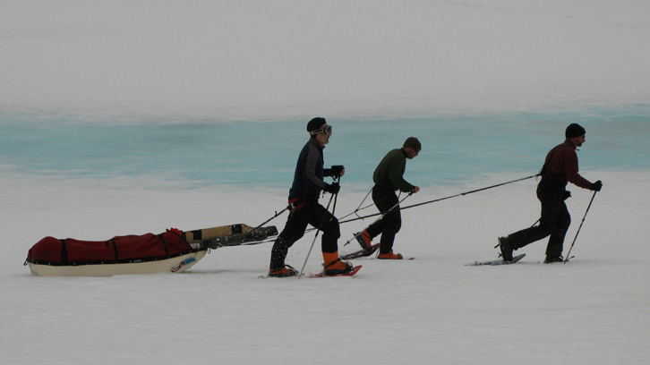
The research team extracting records to date the eruption of the volcano thanks to the ice drilling platform. Photography by Sergi Pla Rabès.
This discovery is an example of serendipity (an unexpected discovery) points out Dr. Sergi Pla Rabès, co-author of the article (associated professor at the BAVBE department of the UAB and researcher at the CREAF). The initial objective of the study was to reconstruct the climate fluctuations of the region over the last 11,700 years starting from the analysis of the sediment records of lakes on Byers Peninsula, only about 40 kilometres north of Island Deception. “However, the presence, from a very differentiated sediment layer of almost a meter after a level of volcanic crystals and ashes, surprised us all. Subsequent geochemical and biological analyses indicated that these sediments were of terrestrial origin, both for their biogeochemistry and for the presence of diatoms that grow on terrestrial and non-lacustrine environments. Carbon dating (C14) indicated that this material had accumulated suddenly and synchronously in all Byers Peninsula lakes. These results indicate the occurrence of a major earthquake that affected all the lakes in the area around 4,000 years B.P., indicating that maybe we were facing the earthquake that generated the collapse of the volcanic caldera of the Island Deception", explains Dr Sergi Pla-Rabés, UAB-CREAF.
The Livingstone area (Byers peninsula) where sedimentary records were recovered, 40 km from Deception Island. Photography by Sergi Pla Rabès.
Thanks to the multidisciplinary team of geologists, vulcanologists and biologists and the inclusion of new geological and petrological analyses, authors found out that the tephra and ashes recovered from the lake sediments had their origin in the Deception volcano. At the same time, they were able to calculate the conditions of pressure and temperature of the magmas that generated the eruption from the analysis of the ashes sampled, and thus they could estimate the depths of origin of each sample and specify whether they belonged to the same magma and the same eruption.
Also, according to this study, the Volcanic Explosivity Index (VEI) was 6, which possibly makes it the most massive eruptive episode of the Holocene known and dated from the Antarctic continent. The formation of the Deception caldera ejected from 30 to 60 cubic kilometres of volcanic material that reached about 4,600 kilometres away. Volcanic eruptions of this magnitude have caused sudden changes in the global climate of the planet, with significant consequences for societies and ecosystems. Now it is necessary to know what impact this eruption had on the earth system as a whole.
Acknowledgements:
The multidisciplinary study was done thanks to several projects and research institutions (see above) and framed in the research ANTALP (Antarctic, Arctic, Alpine Environments) research group that is supported by the AGAUR of the Generalitat de Catalunya Government.
Department of Animal Biology, Plant Biology and Ecology (BAVBE)
CREAF
Universitat Autònoma de Barcelona
References
Antoniades, D., Giralt, S., Geyer, A., Alvarez-Valero, A.M., Pla-Rabes, S., Granados, I., Liu, E.J., Toro, M., Smellie, J.L. and Oliva, M. (2018). The timing and widespread effects of the largest Holocene volcanic eruption in Antarctica. Scientific Reports 8,17279 DOI: 10.1038/s41598-018-35460-x.