Exhibition of maps from the 17th and 18th centuries
30/10/2017
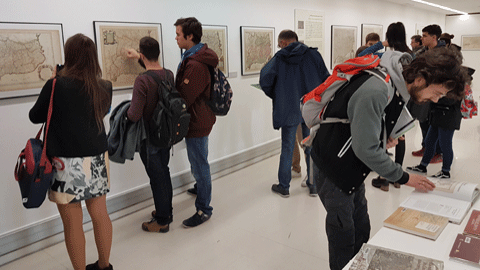
Until 15 December, the UAB exhibition hall (located on the ground floor of the Communication Library and General Newspaper Archives, Plaça Cívica) will be displaying a series of maps from the 17th and 18th centuries from the UAB's Gelabertó collection. The presentation of the exhibition will take place on 15 November at noon.
In 2015, the UAB signed an agreement with historian Martí Gelabertó in order to incorporate into its General Map Library a collection of 180 maps and drawings of Catalonia from the 17th and 18th centuries. The collection mainly is made up of maps and drawings of Catalonia, both of the whole country and of specific cities, and also includes layouts of military forts and views of the cities at that time, many of them drawn during the violent conflicts which devastated Catalonia between 1640 and 1714. The collection of maps, which is catalogued and digitalised, can be viewed at ddd.uab.cat/collection/mapesgelaberto.
The exhibition is structured into two large blocks. One part focuses on Catalonia in the 17th and 18th centuries, and the other offers aerial views and street maps of Barcelona. The exhibition is organised by the General Map Library and Cultura en Viu, with the support of the Department of Geography and the Department of Modern and Early Modern History.